Wurstkoffer
Member
Thanks Les Neilson for the tutorial. Im pretty sure interpolation is needed for plain text data also.
 . rally tracks are a must !. and well that's crazy, flat areas need no polys when you first subdivide the initial inject. but anyway theres a lot I can help with here so I shall. one thing is to see what a high poly output from rtb looks like , then pro optmised, and using the wireframe image of that as the texture would show you where to paint the very initial subdivides. only way I can think to achieve optmised scenery firstly in rtb. its certain though that without optomisation ,nothing will be that possible in rtb alone. rtb to game will result in a serious and impossible mess that will never work..
the main way to manage it all is to be able to change it later on. and this means learning blender or 3dsmax, if you scratch my back ill scratch yours though. and you are right when you say you need to re think it. these days its not so much the end result visually but how its put together. this data should be considered as reference data initially. what RTB will do very well though is give you that awesome track layout, that you can use to learn in the bigger programs.Now that this level of data is starting to become more available, of course modders will want to make use of it. I like making country road tracks based on real locations, and being able to model terrain to this level of detail is really the holy grail for me. But it seems I'll need to rethink how to manage it. Thanks for the feedback. I'm interested to see what might be done. I was looking forward to driving that track last night...
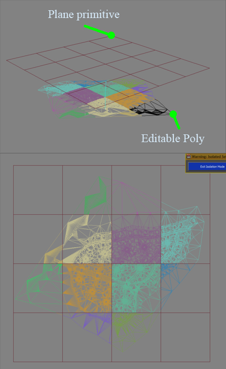
This one has 210,000...If RTB fails, just export to a format you can import in Blender/Max and split the bigger meshes. The only condition is that any single mesh does not have more than 65k values (values include everything - verts, uv coordinates, etc).
- on Tapatalk
