• Dear visitors,

    The email issue has been finally solved.
    Thank you for your patience and happy browsing.

    Team ACM.

TUTORIAL Race Track Builder - Inject elevation data and terrain texture

bcorner

New Member
There is already a project in progress for Barber on Lidar data.
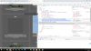
very cool. ive got the tracks walls bumper strips. A good bit overall. Except the buildings. I found a source for those. and had started editing them in blender. I edited them on the google earth and fixed things like the heights, some labels and a few misc items. I had not started skinning them. yet.
overview.jpg
View attachment 2659
view2.jpg


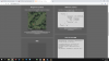
I just moved to the Alpharetta area. I got invited to go race there but have prior obligations. So the track looked so good I wanted to drive it virtually at least. I searched high and low for someone already working on one but to no avail. So started my own mini project. Im more of a linux guy so learning some of this windows GIS/ 3d stuff
 
Last edited:

Les Neilson

Active Member
Ah, you know something about GIS servers? That could be very useful... I've been fumbling around with Geoserver, and occasionally I can get it to work. Have you ever used it? RTB becomes a completely different tool once you start importing lidar directly
 

bcorner

New Member
Its been a few years. and I used linux for my base OS. so learing how to setup in windows. But it does give me a head start. I used to make layers for a large Multiple Listing Service.
 

Les Neilson

Active Member
The magic words I'd like to get my head round are Layers and Tiling. Layers because I've downloaded lidar at different resolutions that cover various bits of the same area. In theory it shouldn't be difficult to pick the highest res available and blend in the lower res where necessary. Tiling because it would be great just to throw all the bits into a folder and let the app pick them out and stitch them together by itself
 

Pixelchaser

Well-Known Member
from Brendon.

Time for another update. I am still working on the next release which will include the ability to add plugins to source the height and image data. Some people have expressed a desire to load data from alternative sources, with Wurstkoffer producing an amazing work-around solution for this … https://steamcommunity.com/sharedfiles/filedetails/… . In the future this will allow other bright people to produce their own interfaces allowing RTB to use image/height data from any pote...ntial source.

As some may already know Google announced they are changing the way they allow people to access their data. Whilst it’s not entirely crystal clear, I suspect newcomers will need to add a payment method to their Google account and even though the data will be free, if you hit a Google’s limit then Google will start charging. For existing customers they state “If you choose not to add a billing account, there is a risk that if your usage exceeds $200 in a given month, your Maps API implementation will be degraded or other API requests will return an error.”. More on that here … https://cloud.google.com/maps-p…/user-guide/pricing-changes/

This is my first foray into developing Plugins so I welcome any feedback, advice and requests here in the forums … https://steamcommunity.com/…/discuss…/0/1694920442943936878/ . Since this is area I have little (none) experience in I expect the plugin will evolve and quite possibly break backward compatibility so be prepared that any plugin you develop might need to change.
 

luchian

Administrator
Staff member
Hmm.. so Brandon's onboard, but Google not so much anymore. Luckly there is Lidar. With or without them.

- on Tapatalk
 

Les Neilson

Active Member
So, the idea is that RTB will be modded to allow third party plugins to provide terrain (and presumably texture) data. I'd definitely be interested in working on this, but I'll admit straight away I don't have that much development experience, and none at all regarding plugins...
 

Modex007

New Member
Hi, i have my locations data in *.xyz file where i can find:
315963.290 6198775.020 14.951
315963.260 6198778.280 15.131
315963.250 6198779.990 14.981
315963.230 6198781.670 14.961
315963.220 6198783.340 14.861
315963.210 6198784.950 14.941


etc....

How i could merge that with google maps and use it in RTB ? any ideas ?
 

darin baughman

New Member
Looking for some help with the direct inject tutorial. everything works great until i load the test were i should get the 3 images 1 for google 1 from wms and a stitched pair. I don't receive any of the wms pair. uninstalled and followed the tutorial again with same result. Anyone with any advice would be great. thanks
I have gotten futher along but now i get this with no pic in wms and logs show only google when i try to have RTB pull data> any help would be greatly appreciated. thanks
 

Attachments

barf

Member
I have gotten futher along but now i get this with no pic in wms and logs show only google when i try to have RTB pull data> any help would be greatly appreciated. thanks
Hi Darin, I don't use RTB so I might not be much help, but the web services look like they are using different map projections. One screenshot has a request for EPSG:3857 (WGS84 pseudo-mercator, presumably because Goog) data but the other screenshot shows projection EPSG:7837 (a localised German elevation data projection).

If it is possible to, configure RTB use a localised map projection (ie; the one your source elevation data uses) or UTM zone, because making tracks in pseudo-mercator will introduce scale error. If RTB can't use other projections, look at the parameters in your WMS requests, see if it's possible to request data in pseudo-mercator. Any sensible cartographic/GIS system will by default return data in the localised projection for that area, but they often also provide layers in 3857 for web maps.
 
Last edited:

darin baughman

New Member
Hi Darin, I don't use RTB so I might not be much help, but the web services look like they are using different map projections. One screenshot has a request for EPSG:3857 (WGS84 pseudo-mercator, presumably because Goog) data but the other screenshot shows projection EPSG:7837 (a localised German elevation data projection).

If it is possible to, configure RTB use a localised map projection (ie; the one your source elevation data uses) or UTM zone, because making tracks in pseudo-mercator will introduce scale error. If RTB can't use other projections, look at the parameters in your WMS requests, see if it's possible to request data in pseudo-mercator. Any sensible cartographic/GIS system will by default return data in the localised projection for that area, but they often also provide layers in 3857 for web maps.
Hi barf thanks for the reply. I do believe that it is to pull from 2 different data sets. on page 1 of this thread there is a tutorial showing the set up and the top picture should be a pic with goog and the wms pic stitched together. middle that is blank should show half of wms pic and the bottom one should be like in my screenshot showing goog pic. And sorry in advance if i totally missed your advice this is over my head a little bit to say the least
 

darin baughman

New Member
Hi Darin, I don't use RTB so I might not be much help, but the web services look like they are using different map projections. One screenshot has a request for EPSG:3857 (WGS84 pseudo-mercator, presumably because Goog) data but the other screenshot shows projection EPSG:7837 (a localised German elevation data projection).

If it is possible to, configure RTB use a localised map projection (ie; the one your source elevation data uses) or UTM zone, because making tracks in pseudo-mercator will introduce scale error. If RTB can't use other projections, look at the parameters in your WMS requests, see if it's possible to request data in pseudo-mercator. Any sensible cartographic/GIS system will by default return data in the localised projection for that area, but they often also provide layers in 3857 for web maps.
Ok after reading and figuring out your advice. I see what your saying here is some shots of the php file that is asking for the data. and also some shots of the inspected url. My test returns the 7837 but in the example its it returns 5783 but calls for 3857. Not sure whats up here. anyway if I can't figure this out ill just move on to blender which i guess i should do anyway. Thanks for your help.
 

Attachments

barf

Member
I wish I could be more help! Good luck!

Maybe check that the pattern matching works? I just noticed the pattern search in your php file looks like ASCII, maybe it is not matching the German UTF-8 characters in the reply?
 

darin baughman

New Member
I wish I could be more help! Good luck!

Maybe check that the pattern matching works? I just noticed the pattern search in your php file looks like ASCII, maybe it is not matching the German UTF-8 characters in the reply?
thanks for your help... not sure this is still trying to just get the tutorial deal to run. its not even to the RTB test but the author is supposed to release a plugin possibility so if I don't abandon RTB before maybe I can use it when its updated.
 

Pixelchaser

Well-Known Member
id wait for a year before brendon is anywhere near starting that plugin :lol:. he also said he was going to put in Bezier curves too. that was requested 4 years ago and it was the number one thing asked for.
 

darin baughman

New Member
id wait for a year before brendon is anywhere near starting that plugin :lol:. he also said he was going to put in Bezier curves too. that was requested 4 years ago and it was the number one thing asked for.
Yeah blender 2.8 will more than likely be a full release before he gets it done. Then I'll just learn on that. I wasted $60 on worse things in my life
 
Top