• Dear visitors,

    The email issue has been finally solved.
    Thank you for your patience and happy browsing.

    Team ACM.

TOOL RTB- Race Track Builder

Pixelchaser

Well-Known Member
yeah getting close in helps and the off set height figures help too. and always hold x or Y when moving to constrain any axis, because it is perspective based and not orthographically viewable this is essential without it you can be moving on an axis and not even know it.

I can do prescribed demonstrations of any rtb stuff shortly via stream and voice chat. and once my hospital shit is out the way.
 

Ricardo Rey

Active Member
Thanks @Pixelchaser & @Johnr777 !

That's basically what I am doing now; zoom. It would be nice if a mouse scroll would change it, or a mouse menu option with control box. But, I'm getting use to it. Didn't know if there was a better way.

Cheers!
 

Ricardo Rey

Active Member
There are a few things that I'm trying to do and can't figure out a way to accomplish in RTB. I'm trying to get a track layout in RTB and have tried various ways. If I use Google, the track layout is there and can modify to get the proper track, but the terrain is wrong because of excavation and have found no way to alter it.
If I start with a blank canvas with no elevation, I have not found an easy way to get the layout in. I may have too much information in the fbx for RTB to load. I would prefer to start with a flat canvas. I would really appreciate some help here.

EDIT: Well, I managed to get the track in a flat canvas, now to figure out how to scale it.:lol:
 
Last edited:

Pixelchaser

Well-Known Member
I can help but I need to replicate what you are doing and this would be the best tutorial for you tbh. so show me the cooridnates, and give me some understanding and ill show you 2 methods of how to get there.
 

Ricardo Rey

Active Member
This is the coordinates for one I have been practing on; Buttunwillow: 35.4911248,-119.5498774
 

Pixelchaser

Well-Known Member
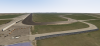
ok I see the track, so if I wanted to make that on blank flat area. I would firstly capture the are with the height in rtb, mainly to get the image of the terrain from rtb.

when rtb is done and its terrain is in front of you, goto edit materials. select the one that the background image is on and take note of all the texture coordinates.. and save that image somewhere.

without leaving rtb on that project simply goto setup new project, the world coordinates will remain in the history, and turn off it off. (un check latitude, longitude) and keep the width and depth the same as the first capture.

this will produce a flat blank area. then go into edit materials and set the first background image you saved in place of whats there for the new background. and put in the texture coordinates you saves and voila. you have that same area but flat.

OR.....

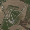
whilst you have captured the height version in RTB, simply turn off terrain capture in the edit/venue menu, and the tools on the terrain tab will change to the terrain edit tools. from here you can select a 1000 m and the flatten tool and where you first click will flatten the whole scenery, keep it held and paint for flatness.


then you can use the other edit tools to sculpt your terrain as you see fit. its not very good to be honest, requires a lot of patience and undo functions. but that's how to edit a height captured terrain. the only caveat is that you cant go back to capturing terrain from it..


Last edited:

Ricardo Rey

Active Member
Awesome. Option 1 worked best. Many thanks!!!!
 

Ricardo Rey

Active Member
I was attempting to practice adjusting camber on a flat surface. I am now playing with the terrain tool. But I was also using the track extensions past the track, like in Brandon's video.
 

Pixelchaser

Well-Known Member
its best to let the sides of track on the cross section control the scenery the leads of the camber of the track edge. trying to shape the terrain itself like that would be an exercise in futility :lol:

don't rule out using a piece of track for the terrain too btw. that's actually the most powerful way to make terrain in rtb as you have the cross sections for smooth contouring etc. just break your ideas down into primitive basic shapes and then you can get funky with it.
 

Pixelchaser

Well-Known Member
for example. the scenery and how land joins to the sea via a beach, which is eroded land is quite unique to try create, so I use a road and the cross section to get the beach drop like here.

just examples of using road tools for non road things.


and here I make the scenery for the island with a road tool too. as it cuts the terrain it becomes the terrain. with the terrain material function.
 
Last edited:

Ricardo Rey

Active Member
To be honest, I started the scratch Early Mexico track in RTB and have most of the track done with the hairpin camber and pits. That little hill above will be used as well.
 

Johnr777

Moderator
Decided to go a simpler route to learn RTB, this is the track from my avatar - Toronto Motorsports Park

tmp-editor.png
Flat, virtually no - to very little corner camber... very easy to model and therefore learn this tool :lol:

RTB pulled a kinda low res sat image... Im attaching a 1024 version of the 4096 PNG the tool created... maybe one of the great minds here can fetch a 8192? The tool Ali uses doesnt work for me... wont save?

tmp.png
 

Johnr777

Moderator
Not at home till the end of the day unfortunately, so i cant boot up RTB, but google map's coordinates are 42.9027514,-79.8551651
 

Johnr777

Moderator
ok ill have a look in a bit.

when you say through gms it wont save, does it give an error?
No, that’s the weird part, I can go through the process, select the format, folder, then hit save, but no file is ever created. Tried different formats, tried running GMS in admin mode... made sure I waited long enough because of the size of the file... Nothing :(
 
Top