• Dear visitors,

    The email issue has been finally solved.
    Thank you for your patience and happy browsing.

    Team ACM.

W.I.P. Summit Road, Christchurch, New Zealand

barf

Member
Summit Road, Christchurch, New Zealand

About
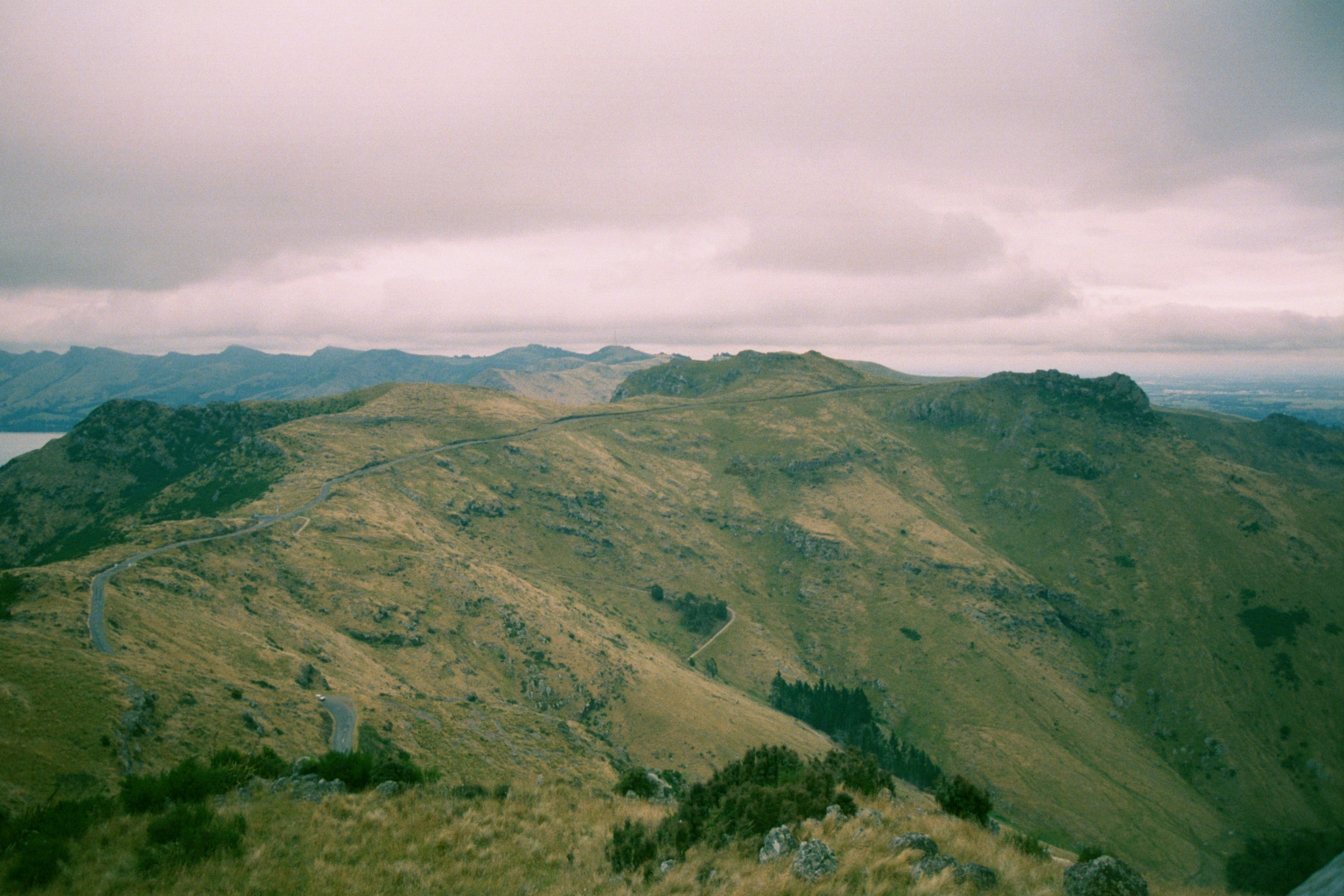
Summit Road is listed as one of the world's most dangerous roads. It is a narrow, winding road which follows the crater rim of a giant, extinct volcano in Christchurch, New Zealand.

Due to rockfall damage from earthquakes and the risk of further rockfall in aftershocks, sections of the Summit Road were closed.

Development
This is my first AC track and is currently under development. Tasks and issues are being tracked on GitLab. To report a bug please sign up on GitLab and attach a screenshot to a new issue.

The terrain is a 1-meter LiDAR digital elevation model (DEM) from Land Information New Zealand (LINZ), with a vertical accuracy specification of +/- 0.20m (95% confidence). Horizontal accuracy is +/- 1.00m (95% confidence). The final spatial accuracy is approximately ±2m @ 90% in clear open spaces.

The scene is geo-referenced using the NZ Transverse Mercator projection (EPSG:2193). Distant terrain is formed from the Japan Aerospace Exploration Agency's (JAXA) ALOS AW3D30 DSM, which has a 30m horizontal resolution.

1.2m/pixel orthophotos from LINZ were pulled via WMTS in QGIS for the terrain texturing. The overall scene size is approximately 35x40km.

Screenshots


Video

Support
This track is free but if you are comfortable donating a coffee or beer, any support is appreciated!
Paypal


Licence
This track is free, but please do not modify, disassemble or redistribute it without permission of the author.

The LiDAR DEM and aerial imagery is sourced from the LINZ Data Service and licensed by Environment Canterbury Regional Council, for re-use under the Creative Commons Attribution 4.0 International licence.

The ALOS AW3D30 DSM is Copyrighted by the Japan Aerospace Exploration Agency (©JAXA).

Download
The track is currently under development, however test releases are public and feedback is welcome! The latest test release can be found on the project Discord:
https://discord.gg/j3ND23w
 
Last edited:

luchian

Administrator
Staff member
Hi there. Very interesting and abitious project. It sounds well thought at first glance.
Good luck with it, will be following this.
 

barf

Member
yep still going, had a 3 month holiday and I started to miss blender :D

progress today:
  • added some road cones, some objects at sign of the kiwi, sugar loaf and mt pleasant rd
  • fixed the paths to textures which changed when moving to git
  • road contouring/flattening
  • sun azimuth/elevation corrected for 8th nov 2015 (date of orthophotography so shadows line up)
  • placed down big fuel tanks at lyttleton wharf
 

barf

Member
A (slow) progress update! :whistle:


Starting to get the feeling this could take 6 months and need a GANTT chart :eek:
  • Stage re-organisation into special stages and rename to "Port Hills Touge". This name better represents the scene and roads, which now also includes Evans Pass Road, Sumner Road and Dyers Pass Road.
  • Re-contouring and subdividing the (1m) LiDAR mesh into a drive-able physical mesh continues. Approximately 20 of 45-50km done.
  • During testing the DIP is around 900-1100 with terrain mesh alone! :( and objects are being introduced to the scene now.. I hope this number is not too high? (My friend reports 60-120 FPS, I get 30-60 but my graphics card isn't the greatest)
Making some trips to location to take measurements, and collect building and signage texture images over the xmas holidaze! ;)

It might help people gain an understanding and appreciation for how dangerous this road is here:
https://www.stuff.co.nz/national/109256092/person-killed-in-crash-on-christchurchs-dyers-pass-rd

The road is narrow (down to ~7.5m), sided by steep cliffs and banks, and Armco barrier coverage is very limited. Drive safe these holidays everyone!
 
Last edited:

barf

Member
I tried to follow the video in the build-your-first-track tutorial and make a road surface with nurbs paths and array and curve modifiers, which I could drape over the road using the shrinkwrap modifier. But the plane generated doesn't follow the path like in the tutorial video.

Can anyone see what I'm doing wrong here?
 

Attachments

Pixelchaser

Well-Known Member
nice big project. I guess it`ll be an la canyons rival... looks so much like where i am from in scotland…
 

luchian

Administrator
Staff member
I tried to follow the video in the build-your-first-track tutorial and make a road surface with nurbs paths and array and curve modifiers, which I could drape over the road using the shrinkwrap modifier. But the plane generated doesn't follow the path like in the tutorial video.

Can anyone see what I'm doing wrong here?
Make sure they both have the origin in the same point.
 

barf

Member
Thanks luchian! (this project is my introduction to blender!)

the origins were the same position, but I had rotated the origin of the path and needed to apply the same rotation to the plane object :banghead:
 

barf

Member
The first resemblance of a road!


This was a nurbs path used over a road-texture plane with array and curve modifiers, then shrinkwrap down to the LiDAR mesh. The LiDAR mesh pokes through it in places, but a step forward!
 

AccAkut

Active Member
The first resemblance of a road!


This was a nurbs path used over a road-texture plane with array and curve modifiers, then shrinkwrap down to the LiDAR mesh. The LiDAR mesh pokes through it in places, but a step forward!
Make two vertex groups, one for the verts in the middle and one for the edge only. Then use separate shrink-wrap modifiers for both, the middle one with some distance to the ground :)
 

barf

Member
Make two vertex groups, one for the verts in the middle and one for the edge only. Then use separate shrink-wrap modifiers for both, the middle one with some distance to the ground :)
Thanks AccAkut! I will try that! I'm still a total noob in Blender: need to figure out this UV mapping stuff at some stage too ;-)

After making that one small section of road I realised tracing all these center-lines out would make my carpal tunnel worse :p so I imported an ESRI Shapefile of NZ's road center-lines, and it looks pretty cool!


This got me thinking about automating road generation... nirvana.. but enough dreaming :) these are the roads in the scene:


Does anyone know of a method for converting an edge selection (or object) to a nurbs path or Bezier curve?

I want to convert the road center-line vertices (the shapefile contained "POLYLINE" - paths consisting of points) into control points of a Bezier curve but I can't find a UI method. I tried Alt-C to convert a mesh to a curve, but it still looks like straight line segments after :-/

The type property of the object in Python is read-only, so I think the only way is to re-create it using the Blender API..
 
Last edited:

luchian

Administrator
Staff member
I want to convert the road center-line vertices (the shapefile contained "POLYLINE" - paths consisting of points) into control points of a Bezier curve but I can't find a UI method. I tried Alt-C to convert a mesh to a curve, but it still looks like straight line segments after :-/
I never did this specific manipulation, but assuming it DID converted it to a curve, did you try to change the control points to something different ? (e.g. if during conversion they were automatically made say vector, the curve would still look "cornery"). Anyway, to try it out, select the curve, go to edit mode, select a control point and press V then choose a different type.
 

barf

Member
The conversion (in BlenderGIS) makes vertices and edges between them along the polyline.

After I press V and change handle type the vertex looks the same, don't see any curve control widgets :-/


might have a go at this in Python instead :nerd:
 

luchian

Administrator
Staff member

AccAkut

Active Member
Does anyone know of a method for converting an edge selection (or object) to a nurbs path or Bezier curve?

I want to convert the road center-line vertices (the shapefile contained "POLYLINE" - paths consisting of points) into control points of a Bezier curve but I can't find a UI method. I tried Alt-C to convert a mesh to a curve, but it still looks like straight line segments after :-/

The type property of the object in Python is read-only, so I think the only way is to re-create it using the Blender API..
That should simply be "Alt-C" I think. Select an object and press that, choose what you need.
 

barf

Member
Thanks for the help luchian and AccAkut! I found where I went wrong :rolleyes:

After converting with alt-C I needed to select the vertices and 'set spline type' to Bezier, then the curve control handles appeared! Now I have too many control points hehe, the shapefile with road center-line data was approximating curves with additional vertices.
 
Top